Pineywoods Forest
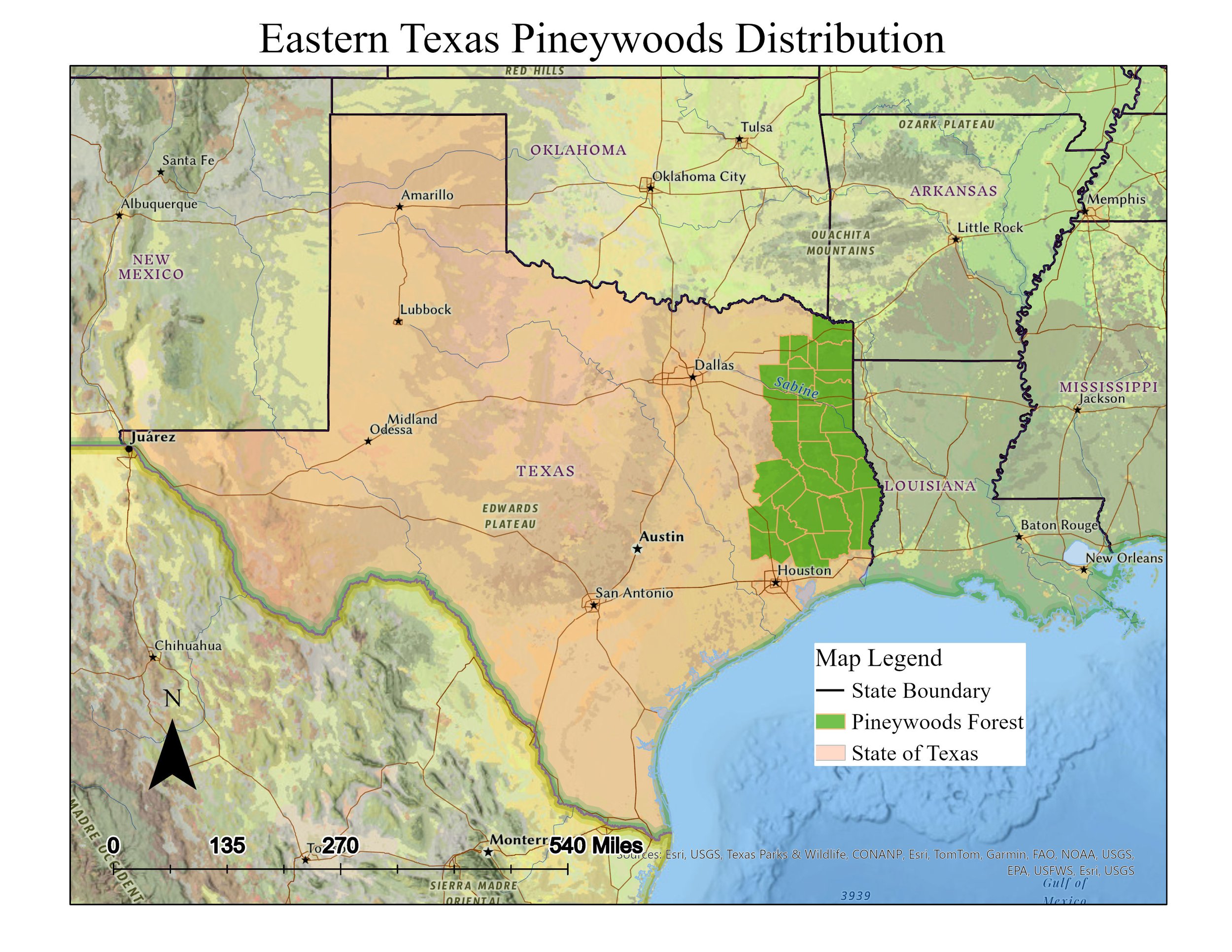
I developed the Pineywoods Forest Project as an in-depth exploration of the unique Pineywoods ecoregion, located across southeastern Texas, Arkansas, Louisiana, and Oklahoma. This project combines my skills in ecological research, visual media, and data analysis to communicate the significance of this region’s biodiversity and environmental challenges.
I mapped the geographic distribution of the Pineywoods using ArcGIS, showcasing the habitat range of key species and ecological zones, while also analyzing climate patterns over a 30-year period in Excel to illustrate how temperature and rainfall shape the region’s ecosystems. Through this project, I highlighted distinctive species and examined how these species interact with the environment and face threats from invasive species, logging, and fire suppression.
To make this complex information accessible, I created visual components such as a detailed map, climate graph, and compiled photographs that capture the Pineywoods’ natural beauty and biodiversity. My project also outlines targeted restoration efforts and sustainable management practices. This project not only reflects my technical abilities but also my story-telling and commitment to using media and data to inspire conservation and understanding of critical areas.

Wolverine Reintroduction
I designed and executed the Wolverine Reintroduction Project to assess the ecological suitability of Lake County, Colorado, for wolverine reintroduction—a project that highlights both my technical skills in GIS and my understanding of ecological restoration principles. This initiative involved a detailed analysis of habitat factors crucial for supporting wolverine populations. My approach focused on applying advanced GIS techniques to deliver a comprehensive, data-driven assessment that supports biodiversity and ecosystem balance.
Using ArcGIS, I applied various spatial analysis tools to isolate specific land types, and used buffer zones around roads and urban centers to minimize human-wildlife conflict. I then incorporated raster data on land and snow cover, reclassified and calculated for suitable conditions, and generated a final map of ideal habitat for wolverines in Lake County.
This project is not only technically robust but also aligns with current efforts in conservation biology, making it an informative addition to my portfolio for roles in environmental management or ecological research. By combining scientific research, spatial analysis, and ecological insight, I was able to create a practical and comprehensive guide for potential reintroduction, illustrating my strengths in using technology to solve real-world conservation challenges.
